Hongjua). El Niño is the most powerful current in the world's oceans (based on materials from
Author: S. Gerasimov
On April 18, 1998, the newspaper “World of News” published an article by N. Varfolomeeva “Moscow snowfall and the mystery of the El Niño phenomenon” which stated: “...We have not yet learned to be scared at the word El Niño... It is El Niño that is a threat to life on the planet ... The El Niño phenomenon has been practically unstudied, its nature is unclear, it cannot be predicted, which means it is, in the full sense of the word, a time bomb... If efforts are not immediately made to clarify the nature of this strange phenomenon, humanity cannot be sure of the future " Agree that all this looks quite ominous, it’s just scary. Unfortunately, everything that is described in the newspaper is not fiction, not a cheap sensation to increase the circulation of the publication. El Niño is a real unpredictable natural phenomenon - a warm current so affectionately named.
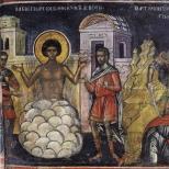
"El Niño" means "baby" or "little boy" in Spanish. This tender name originated in Peru, where local fishermen have long been faced with an incomprehensible mystery of nature: in other years, the water in the ocean suddenly heats up and moves away from the shores. And this happens just before Christmas. That's why the Peruvians connected their miracle with the Christian mystery of Christmas: in Spanish, El Niño is the name for the Holy Child Christ. True, before it did not bring such troubles as it does now. Why does a phenomenon sometimes demonstrate its full strength, while in other cases it shows almost no effect? And what caused the Peruvian miracle, the consequences of which are very serious and sad?
For 20 years now, an entire scientific army has been exploring the space between Indonesia and South America. 13 meteorological vessels, replacing each other, are constantly in these waters. Many buoys are equipped with instruments to measure water temperature from the surface to a depth of 400 meters. Seven planes and five satellites are patrolling the skies over the ocean to get an overall picture of the state of the atmosphere, including understanding the mysterious natural phenomenon El Niño. This occasionally occurring warm current off the coast of Peru and Ecuador is associated with the occurrence of unfavorable weather disasters around the world. It is difficult to follow it - this is not the Gulf Stream, stubbornly moving along a set route for thousands of years. And El Niño occurs, like a jack-in-the-box, every three to seven years. From the outside it looks like this: from time to time in the Pacific Ocean - from the coast of Peru all the way to the islands of Oceania - a very warm giant current appears, total area equal to area USA – about 100 million km2. It extends into a long, tapering sleeve. Over this vast space, as a result of increased evaporation, colossal energy is pumped into the atmosphere. The El Niño effect releases energy with a capacity of 450 million megawatts, which is equal to the total capacity of 300 thousand large nuclear power plants. As if one more - additional - Sun rises from Pacific Ocean, warming our planet! And then here, as if in a giant cauldron, between America and Asia, the signature climatic dishes of the year are cooked.
Naturally, the first to celebrate its “birth” are Peruvian fishermen. They are concerned about the disappearance of schools of sardines off the coast. The immediate reason for the departure of the fish lies, as it turns out, in the disappearance of food. Sardines, and not only them, feed on phytoplankton, component which are microscopic algae. And algae needs sunlight and nutrients, primarily nitrogen and phosphorus. They are present in ocean water, and their supply in the upper layer is constantly replenished by vertical currents going from the bottom to the surface. But when the El Niño current turns back, towards South America, his warm waters“block” the outlet of deep waters. Biogenic elements do not rise to the surface, and algae reproduction stops. The fish leave these places - they do not have enough food. But sharks appear. They also react to “problems” in the ocean: bloodthirsty robbers are attracted by the water temperature - it rises by 5-9 ° C. It is precisely this sharp increase in the temperature of the surface layer of water in the eastern Pacific Ocean (in the tropical and central parts) that is the El phenomenon. Niño. What's happening to the ocean?
In normal years, warm surface ocean waters are transported and retained by easterly winds - the trade winds - in the western zone of the tropical Pacific Ocean, where the so-called tropical warm pool (TTB) is formed. It should be noted that the depth of this warm layer of water reaches 100-200 meters. The formation of such a huge heat reservoir is the main thing necessary condition birth of El Niño. At the same time, as a result of the surge of water, the sea level off the coast of Indonesia is two feet higher than off the coast of South America. At the same time, the water surface temperature in the west in the tropical zone averages +29-30° C, and in the east +22-24° C. A slight cooling of the surface in the east is the result of the rise of deep cold waters to the ocean surface due to water suction trade winds. At the same time, the largest region of heat and stationary unstable equilibrium in the ocean-atmosphere system is formed above the TTB in the atmosphere (when all forces are balanced and the TTB is motionless).
For unknown reasons, once every three to seven years the trade winds suddenly weaken, the balance is upset and the warm waters of the western basin rush east, creating one of the strongest warm currents in the World Ocean. Over a vast area in the eastern Pacific Ocean, in the tropical and central equatorial parts, there is a sharp increase in the temperature of the surface layer of the ocean. This is the onset of El Niño. Its beginning is marked by a long onslaught of squally westerly winds. They replace the usual weak trade winds over the warm western part of the Pacific Ocean and block the rise of cold deep waters to the surface, that is, the normal circulation of water in the World Ocean is disrupted. Unfortunately, such a scientific, dry explanation of the causes is nothing compared to the consequences.
But then a giant “baby” was born. Each of his “sighs”, each “wave of his little hand” causes processes that carry global character. El Niño is usually accompanied by environmental disasters: droughts, fires, heavy rains, causing flooding of vast areas of densely populated areas, which leads to the death of people and the destruction of livestock and crops in different regions of the Earth. El Niño also has a significant impact on the state of the global economy. According to American experts, in 1982-1983 the economic damage from his “pranks” in the USA amounted to 13 billion dollars and from one and a half to two thousand people died, and according to the estimates of the world’s leading insurance company Munich Re, the damage in 1997-1998 is estimated at already 34 billion dollars and 24 thousand human lives.
Drought and rain, hurricanes, tornadoes and snowfalls are the main satellites of El Niño. All this, as if on command, falls to the Earth in unison. During his “coming” in 1997-1998, fires turned the tropical forests of Indonesia into ashes, and then raged across the vast expanses of Australia. They reached the outskirts of Melbourne. The ashes flew to New Zealand - 2000 kilometers away. Tornadoes swept through places where they had never been. Sunny California was attacked by “Nora” - a tornado (as a tornado is called in the USA) of unprecedented size - 142 kilometers in diameter. He rushed over Los Angeles, almost tearing the roofs off the Hollywood film studios. Two weeks later, another tornado, Pauline, struck Mexico. The famous resort of Acapulco was attacked by ten-meter ocean waves - buildings were destroyed, the streets were littered with debris, garbage and beach furniture. The floods did not spare South America either. Hundreds of thousands of Peruvian peasants fled from the onset of water that fell from the sky, their fields were lost, flooded with mud. Where streams used to gurgle, turbulent streams rushed through. The Chilean Atacama Desert, which has always been so unusually dry that NASA tested its Mars rover there, was hit by torrential rains. Catastrophic floods were also observed in Africa.
In other parts of the planet, climate turmoil has also brought misfortune. In New Guinea, one of the largest islands on the planet, mainly in its eastern part, the land is cracked by heat and drought. Tropical greenery dried up, wells were left without water, crops died. Half a thousand people died of hunger. There was a threat of a cholera epidemic.
Usually a “little boy” frolics for about 18 months, so the planet has time to change seasons several times. It makes itself felt not only in summer, but also in winter. And if at the turn of 1982-1983 in the village of Paradise (USA) 28 m 57 cm of snow fell in a year, then in winter season 1998/99, thanks to the El Niño phenomenon, drifts of 29 meters 13 cm grew in a few days at the ski base on Mount Baker.
And if you think that these cataclysms do not affect the vast expanses of Europe, Siberia or Far East, then you are deeply mistaken. Everything that happens in the Pacific Ocean reverberates throughout the planet. This is a monstrous snowfall in Moscow, and 11 floods of the Neva - a record for three hundred years of the existence of St. Petersburg, and +20 ° C in October in Western Siberia. It was then that scientists began to speak with alarm about the retreat of the permafrost border to the north.
And if earlier meteorologists and other specialists did not know what caused such a “collapse” in the weather, now the cause of all disasters is considered to be the return movement of the El Niño current in the Pacific Ocean. They study it up and down, but cannot squeeze it into any framework. Scientists just shrug their shoulders – this is an anomalous climate phenomenon.
And what’s most interesting is that they paid attention to this phenomenon only in the last 100 years. But, as it turns out, the mysterious El Niño has existed for many millions of years. Thus, archaeologist M. Moseli claims that 1100 years ago a powerful current, or rather, the rivers generated by it natural disasters, destroyed the system of irrigation canals and thereby destroyed the highly developed culture of a large state in Peru. Humanity simply had not previously associated these natural disasters with it. Scientists began to carefully analyze everything connected with the “baby”, and even studied his “pedigree”.
The Huon Peninsula in the island area was chosen to reveal the secrets of El Niño. New Guinea. It consists of a series of coral reef terraces. Part of this island is constantly rising due to tectonic movement, and thus bringing to the surface samples of coral reef that are approximately 130,000 years old. Analysis of isotopic and chemical data from these ancient corals helped scientists identify 14 climate “windows” of 20-100 years each. Cold periods (40,000 years ago) and warm periods (125,000 years ago) were analyzed in order to assess flow patterns in different climate regimes. The coral samples obtained indicate that El Nino used to be not as intense as it has been in the last hundred years. Here are the years in which its anomalous activity was recorded: 1864,1871,1877-1878,1884,1891,1899,1911-1912, 1925-1926, 1939-1941, 1957-1958, 1965-1966, 1972, 1976, 1982 -1983, 1986-1987, 1992-1993, 1997-1998, 2002-2003. As you can see, the El Niño “phenomenon” is happening more often, lasting longer and causing more and more trouble. The periods from 1982 to 1983 and from 1997 to 1998 are considered the most intense.
The discovery of the El Niño phenomenon is considered the event of the century. After extensive research, scientists have discovered that the warm western basin typically enters an opposite phase, called La Niña, a year after an El Niño, when the eastern Pacific Ocean cools 5 degrees Celsius below average. Then recovery processes begin to take effect, bringing cold fronts to the western North American coast, accompanied by hurricanes, tornadoes and thunderstorms. That is, the destructive forces continue their work. It was noted that 13 El Niño periods accounted for 18 La Niña phases. Scientists were only able to verify that the distribution of TTB anomalies in the study area does not correspond to normal and therefore the empirical probability of the occurrence of La Niña is 1.7 times greater than the probability of the occurrence of El Niño.
The causes and increasing intensity of reverse currents still remain a mystery to researchers. Climatologists often benefit from historical materials in their research. Australian scientist William de la Mare, having studied old reports from whalers from 1931 to 1986 (when whaling was banned), determined that the hunt, as a rule, ended at the edge of the forming ice. Figures show that the summer ice limit from the mid-fifties to the early seventies shifted in latitude by 3°, that is, approximately 1000 kilometers to the south (we are talking about the Southern Hemisphere). This result coincides with the opinion of scientists who recognize warming globe as a result of human activity. German scientist M. Latif from the Institute of Meteorology in Hamburg suggests that the disturbing influence of El Niño is increasing due to the increasing greenhouse effect on Earth. Unpleasant news about rapid warming is coming from the shores of Alaska: the glacier has become hundreds of meters thinner, salmon have changed their spawning time, beetles that have multiplied due to the heat are devouring the forest. Both polar caps of the planet are causing concern among scientists. However, representatives of science did not agree on the answer to the global question: does the “greenhouse effect” in the Earth’s atmosphere affect the intensity of El Niño?
But experts have learned to predict the arrival of the “baby.” And perhaps that is the only reason why the damage of the last two cycles did not have such tragic consequences. So a group of Russian scientists from Obninsk Institute experimental meteorology under the leadership of V. Pudov proposed new approach to predict El Niño. They decided to develop the already known idea that the emergence of flow is associated with the development tropical cyclones in the Philippine Sea area. Both typhoons and El Niño are consequences of the accumulation of excess heat in the surface layer of the ocean. The difference between these phenomena is in scale: typhoons release excess heat many times a year, and El Niño - once every few years. It was also noticed that before El Niño forms, the ratio always changes atmospheric pressure in two locations: Tahiti and Darwin, Australia. It is precisely this fluctuation in the pressure ratio that turned out to be the stable sign by which meteorologists can now learn in advance about the approach of the “formidable baby.”
edited news VENDETTA - 20-10-2010, 13:02
Ocean currents are horizontal movements of water masses over long distances. There are cold and warm currents, and in their origin main role the winds play. The wind is the creator of the entire complex system of currents that exists in the World Ocean. It is enough to look at the map of the hemispheres to be convinced: the directions of many of the largest currents coincide with the directions of constant winds. That is why these currents are often called by the names of their “creators” - the North and South trade winds, the current of the Western winds and others.
The most powerful current on Earth is the Western Winds. This giant current forms a moving ring - a “water carousel” - around Antarctica and carries 200 times more water than all the rivers of the world combined. The reason for the formation of a mighty stream is the constant westerly winds. They are the “engine” that forces water masses to move around the globe.
Severe "baby"
Currents - most important factor climate formation. By transporting water masses over long distances, along with them the currents also “move” the climatic conditions characteristic of the areas where these masses were previously located. Cold currents lower the air temperature and contribute to a decrease in precipitation; warm ocean currents lead to the opposite result.

But sometimes currents bring extremely unpleasant surprises. This primarily applies to El Niño. Typically, huge masses of surface water heated in the equatorial zone of the Pacific Ocean move along the equator from the coast of South America towards Asia. However, every few years this current turns back and carries warm water masses to the shores of America. It is this “reverse” water flow that the inhabitants of the Chilean and Peruvian coasts nicknamed “El Niño” - “baby, baby.” This name is due to the fact that most often it occurs on the days of the Nativity of Christ. It would seem that what’s bad is that the water temperature off the coast of South America will rise slightly? Meanwhile, thanks to El Niño, short-term fluctuations occur climatic conditions around the world, which often lead to catastrophic consequences.
"Pranks" El Niño
In the early spring of 1997, satellites with infrared cameras recorded a vast “spot” of heated water in the equatorial latitudes of the eastern Pacific Ocean. The 10-12 cm thick layer had a temperature of up to 30 ° C, which is much higher than usual. This alerted meteorologists: in this area a center for the formation of powerful tropical hurricanes. By June, seasonal indicators of atmospheric pressure over the Australian port of Darwin and the island. Tahiti has changed significantly, and fishermen in Peru have begun to regularly catch hammerhead sharks, a fish that lives in the warmest equatorial waters. Forecasters and the media sounded the alarm.
But it was too late - usually in the wilds rain forests Indonesia has already experienced huge fires caused by lack of rain. Then waves of fires swept across the Australian continent. Tornadoes occurred where they had never been observed before, in particular, the giant Hurricane Nora swept over Los Angeles and the California coast. The Chilean Atacama Desert, considered the driest place on the planet, was hit by heavy rains, and on the other side of the globe - in the eastern part of the island. New Guinea - the soil was cracking from heat and drought, vegetation was dying equatorial forests, wells dried up, crops turned to ashes. A famine began among the inhabitants of the island, destroying entire Papuan tribes.
On a global scale, the consequences were very severe: strong winds, floods and high tidal waves during hurricanes caused the death of 24 thousand people; economic losses in different countries exceeded $34 billion; In many regions, agricultural production was reduced as a result of flooding of fields, and where there were no strong winds and rains, long dry periods set in, leading to loss of crops and severe shortages of drinking water.
Scientists believe that the mysterious disappearance of the Mayan civilization in Central America and the fall of the Chinese Tang dynasty, followed by internecine wars and the ruin of the country, were caused by one natural phenomenon - the same El Niño. Despite the fact that both civilizations were located on opposite ends of the Earth, they had one thing in common - the monsoon climate. The well-being of the people depended on seasonal precipitation. However, around 903-907. the rainy season has not arrived. A drought simultaneously struck the cities of Central America and China, which led to prolonged famine and the decline of two major civilizations at once.
The Southern Oscillation and El Niño are a global ocean-atmospheric phenomenon. A characteristic feature of the Pacific Ocean, El Niño and La Niña are temperature fluctuations in surface waters in the tropical eastern Pacific Ocean. The names of these phenomena, borrowed from Spanish local residents and first introduced into scientific use in 1923 by Gilbert Thomas Volcker, mean “baby” and “little one,” respectively. Their influence on the climate of the southern hemisphere is difficult to overestimate. The Southern Oscillation (the atmospheric component of the phenomenon) reflects monthly or seasonal fluctuations in the difference in air pressure between the island of Tahiti and the city of Darwin in Australia.The circulation named after Volcker is a significant aspect of the Pacific phenomenon ENSO (El Nino Southern Oscillation). ENSO is many interacting parts of one global system of ocean-atmospheric climate fluctuations that occur as a sequence of oceanic and atmospheric circulations. ENSO is the world's best known source of interannual weather and climate variability (3 to 8 years). ENSO has signatures in the Pacific, Atlantic and Indian Oceans.
In the Pacific, during significant warm events, El Niño warms up and expands across much of the Pacific tropics and becomes directly correlated with SOI (Southern Oscillation Index) intensity. While ENSO events occur primarily between the Pacific and Indian Oceans, ENSO events in the Atlantic Ocean lag behind the former by 12 to 18 months. Most of the countries that experience ENSO events are developing ones, with economies that are heavily dependent on the agricultural and fishing sectors. New capabilities to predict the onset of ENSO events in three oceans could have global socioeconomic implications. Since ENSO is a global and natural part of the Earth's climate, it is important to know whether changes in intensity and frequency could be a result of global warming. Low frequency changes have already been detected. Interdecadal ENSO modulations may also exist.
El Niño and La Niña
Common Pacific pattern. Equatorial winds collect a warm pool of water to the west. Cold waters rise to the surface along the South American coast.AND La Niña officially defined as long-term marine surface temperature anomalies greater than 0.5 °C crossing the Pacific Ocean in its central tropical part. When a condition of +0.5 °C (-0.5 °C) is observed for a period of up to five months, it is classified as an El Niño (La Niña) condition. If the anomaly persists for five months or longer, it is classified as an El Niño (La Niña) episode. The latter occurs at irregular intervals of 2-7 years and usually lasts one or two years.
Increase in air pressure above Indian Ocean, Indonesia and Australia.
A drop in air pressure over Tahiti and the rest of the central and eastern Pacific Ocean.
Trade winds in the South Pacific are weakening or heading east.
Warm air appears near Peru, causing rain in the deserts.
Warm water spreads from the western part of the Pacific Ocean to the eastern. It brings rain with it, causing it to occur in areas that are usually dry.
Warm El Niño current, consisting of plankton-poor tropical water and heated by its eastern outlet in the Equatorial Current, replaces the cold, plankton-rich waters of the Humboldt Current, also known as the Peruvian Current, which contains large populations of game fish. Most years, the warming lasts only a few weeks or months, after which weather patterns return to normal and fish catches increase. However, when El Niño conditions last for several months, more extensive ocean warming occurs and can be severe economic blow for local fishing for the external market.
The Volcker circulation is visible on the surface as easterly trade winds, which move water and air heated by the sun westward. It also creates oceanic upwelling off the coasts of Peru and Ecuador, bringing cold plankton-rich waters to the surface, increasing fish populations. The western equatorial Pacific Ocean is characterized by warm, humid weather and low atmospheric pressure. The accumulated moisture falls in the form of typhoons and storms. As a result, in this place the ocean is 60 cm higher than in its eastern part.
In the Pacific Ocean, La Niña is characterized by unusual cold temperature in the eastern equatorial part compared to El Niño, which, in turn, is characterized by unusual high temperature in the same region. Atlantic tropical cyclone activity generally increases during La Niña. A La Niña condition often occurs after an El Niño, especially when the latter is very strong.
Southern Oscillation Index (SOI)
The Southern Oscillation Index is calculated from monthly or seasonal fluctuations in the air pressure difference between Tahiti and Darwin.Long-term negative values SOIs often signal El Niño episodes. These negative values typically accompany continued warming of the central and eastern tropical Pacific, decreased strength of the Pacific trade winds, and decreased rainfall in eastern and northern Australia.
Positive values SOIs are associated with strong Pacific trade winds and warming water temperatures in northern Australia, well known as a La Niña episode. The waters of the central and eastern tropical Pacific Ocean become colder during this time. Together this increases the likelihood of more rainfall than normal in eastern and northern Australia.
El Niño influence
As El Niño's warm waters fuel storms, it creates increased rainfall in the east-central and eastern parts Pacific Ocean.In South America, the El Niño effect is more pronounced than in North America. El Niño is associated with warm and very wet summer periods (December-February) along the coast of northern Peru and Ecuador, causing severe flooding whenever the event is severe. The effects during February, March, April may become critical. Southern Brazil and northern Argentina also experience wetter than normal conditions, but mainly during the spring and early summer. The central region of Chile receives mild winters with plenty of rain, and the Peruvian-Bolivian Plateau sometimes experiences winter snowfall, which is unusual for the region. Drier and warm weather observed in the Amazon Basin, Colombia and Central America.
Direct effects of El Niño leading to decreased humidity in Indonesia, increasing the likelihood of forest fires, in the Philippines and northern Australia. Also in June-August, dry weather is observed in the regions of Australia: Queensland, Victoria, New South Wales and eastern Tasmania.
The western Antarctic Peninsula, Ross Land, Bellingshausen and Amundsen seas are covered with large amounts of snow and ice during El Niño. The latter two and the Wedell Sea become warmer and are under higher atmospheric pressure.
In North America, winters are generally warmer than normal in the Midwest and Canada, while central and southern California, northwestern Mexico and the southeastern United States are getting wetter. The Pacific Northwest states, in other words, dry out during El Niño. Conversely, during La Niña, the US Midwest dries out. El Niño is also associated with decreased hurricane activity in the Atlantic.
East Africa, including Kenya, Tanzania and the White Nile Basin, experience long periods of rain from March to May. Droughts plague southern and central Africa from December to February, mainly Zambia, Zimbabwe, Mozambique and Botswana.
Warm Pool of the Western Hemisphere. A study of climate data showed that approximately half of the post-El Niño summers experienced unusual warming in the Western Hemisphere Warm Pool. This influences the weather in the region and appears to have a connection to the North Atlantic Oscillation.
Atlantic effect. An El Niño-like effect is sometimes observed in the Atlantic Ocean, where water along the equatorial African coast becomes warmer and water off the coast of Brazil becomes colder. This can be attributed to the Volcker circulation over South America.
Non-climatic effects of El Niño
Along the eastern coast of South America El Niño reduces the upwelling of cold, plankton-rich water that supports large fish populations, which in turn maintain abundance seabirds, whose droppings support the fertilizer industry.Local fishing industries along coastlines may experience shortages of fish during prolonged El Niño events. The world's largest fisheries collapse due to overfishing, which occurred in 1972 during El Niño, led to a decline in the Peruvian anchovy population. During the events of 1982-83, populations of southern horse mackerel and anchovies declined. Although the number of shells in warm water increased, hake went deeper into cold water, and shrimp and sardines went south. But the catch of some other fish species was increased, for example, the common horse mackerel increased its population during warm events.
Changing locations and types of fish due to changing conditions have presented challenges for the fishing industry. The Peruvian sardine has moved towards the Chilean coast due to El Niño. Other conditions have only led to further complications, such as the Chilean government creating fishing restrictions in 1991.
It is postulated that El Niño led to the extinction of the Indian Mochico tribe and other tribes of the pre-Columbian Peruvian culture.
Causes that give rise to El Niño
The mechanisms that may cause El Niño events are still being researched. It is difficult to find patterns that can reveal causes or allow predictions to be made.Bjerknes suggested in 1969 that abnormal warming in the eastern Pacific Ocean could be attenuated by east-west temperature differences, causing weakening in the Volcker circulation and trade winds that move warm water westward. The result is an increase in warm water to the east.
Virtky in 1975 suggested that the trade winds could create a westerly bulge of warm waters, and any weakening of the winds could allow warm waters to move east. However, no bulges were noticed on the eve of the events of 1982-83.
Rechargeable Oscillator: Some mechanisms have been proposed that when warm areas are created in the equatorial region, they are dissipated to higher latitudes through El Niño events. The cooled areas are then recharged with heat for several years before the next event occurs.
Western Pacific Oscillator: In the western Pacific Ocean, several weather conditions could cause easterly wind anomalies. For example, a cyclone in the north and an anticyclone in the south lead to the occurrence east wind between them. Such patterns can interact with the westerly flow across the Pacific Ocean and create a tendency for the flow to continue eastward. A weakening of the westerly current at this time may be the final trigger.
The equatorial Pacific Ocean can lead to El Niño-like conditions with a few random variations in behavior. External weather patterns or volcanic activity can be such factors.
The Madden-Julian Oscillation (MJO) is a critical source of variability that may contribute to the sharper evolution leading to El Niño conditions through fluctuations in low-level winds and precipitation over western and central parts Pacific Ocean. The eastward propagation of oceanic Kelvin waves may be caused by MJO activity.
History of El Niño
The first mention of the term "El Niño" dates back to 1892, when Captain Camilo Carrilo reported at a congress Geographical Society in Lima that Peruvian sailors called the warm northerly current "El Niño" because it is most noticeable around Christmas. Nevertheless, even then the phenomenon was interesting only because of its biological influence on the efficiency of the fertilizer industry.Normal conditions along the western Peruvian coast are a cold southerly current (Peruvian Current) with upwelling water; plankton upwelling leads to active ocean productivity; cold currents lead to a very dry climate on earth. Similar conditions exist everywhere (California Current, Bengal Current). So replacing it with a warm northern current leads to a decrease in biological activity in the ocean and to heavy rains leading to flooding on land. The connection with flooding was reported in 1895 by Pezet and Eguiguren.
Towards the end of the nineteenth century there was increased interest in predicting climate anomalies (for food production) in India and Australia. Charles Todd suggested in 1893 that droughts in India and Australia occur at the same time. Norman Lockyer pointed out the same thing in 1904. In 1924, Gilbert Volcker first coined the term "Southern Oscillation."
For most of the twentieth century, El Niño was considered a large local phenomenon.
The Great El Niño of 1982-83 caused interest to skyrocket scientific community to this phenomenon.
History of the phenomenon
ENSO conditions have occurred every 2 to 7 years for at least the last 300 years, but most of them have been weak.
Major ENSO events occurred in 1790–93, 1828, 1876–78, 1891, 1925–26, 1982–83, and 1997–98.
The most recent El Niño events occurred in 1986-1987, 1991-1992, 1993, 1994, 1997-1998 and 2002-2003.
The 1997–1998 El Niño in particular was strong and brought international attention to the phenomenon, while what was unusual about the 1990–1994 period was that El Niño occurred very frequently (but mostly weakly).
El Niño in the history of civilization
The mysterious disappearance of the Mayan civilization in Central America could be caused by severe climate changes. This conclusion was reached by a group of researchers from the German National Center for Geosciences, writes the British newspaper The Times.Scientists tried to establish why, at the turn of the 9th and 10th centuries AD, at opposite ends of the earth, the two largest civilizations of that time ceased to exist almost simultaneously. We are talking about the Mayan Indians and the fall of the Chinese Tang Dynasty, which was followed by a period of internecine strife.
Both civilizations were located in monsoon regions, the moisture of which depends on seasonal precipitation. However, at the indicated time, apparently, the rainy season was not able to provide the amount of moisture sufficient for the development Agriculture.
The ensuing drought and subsequent famine led to the decline of these civilizations, researchers believe. They link climate change to the natural phenomenon El Niño, which refers to temperature fluctuations in the surface waters of the eastern Pacific Ocean in tropical latitudes. This leads to large-scale disturbances in atmospheric circulation, causing droughts in traditionally wet regions and floods in dry ones.
Scientists came to these conclusions by studying the nature of sedimentary deposits in China and Mesoamerica dating back to this period. The last Emperor The Tang Dynasty died in 907 AD, and the last known Mayan calendar dates back to 903.
Must retreat. It is being replaced by a diametrically opposite phenomenon - La Niña. And if the first phenomenon can be translated from Spanish as “child” or “boy,” then La Niña means “girl.” Scientists hope that the phenomenon will help somewhat balance the climate in both hemispheres, lowering average annual temperature, which is now rapidly flying upward.
What are El Nino and La Nina
El Niño and La Niña are warm and cold currents or characteristic equatorial zone Pacific Ocean opposite extreme values water temperature and atmospheric pressure, which last about six months.
Phenomenon El Niño consists of a sharp increase in temperature (by 5-9 degrees) of the surface layer of water in the eastern Pacific Ocean over an area of about 10 million square meters. km.
La Niña- the opposite of El Niño - manifests itself as a decrease in surface water temperature below the climate norm in the east tropical zone Pacific Ocean.
Together they constitute the so-called Southern Oscillation.
How does El Niño form? Near the Pacific coast of South America there is a cold Peruvian Current, which arises due to the trade winds. About once every 5-10 years, the trade winds weaken for 1-6 months. As a result, the cold current stops its “work”, and warm waters shift to the shores of South America. This phenomenon is called El Niño. El Niño energy can lead to disturbances in the entire atmosphere of the Earth, provokes environmental disasters, the phenomenon is involved in numerous weather anomalies in the tropics, which often lead to material losses and even human casualties.
What will La Niña bring to the planet?
Just like El Niño, La Niña appears with a certain cyclicity from 2 to 7 years and lasts from 9 months to a year. For residents of the Northern Hemisphere, the phenomenon threatens a decrease in winter temperatures by 1-2 degrees, which in current conditions is not so bad. Considering that the Earth has shifted, and now spring comes 10 years earlier than 40 years ago.
It should also be noted that El Niño and La Niña do not necessarily have to succeed each other - there can often be several “neutral” years between them.
But don't expect La Niña to come quickly. Judging by observations, this year will be under the rule of El Niño, as evidenced by monthly data on both a planetary and local scale. “Girl” will begin to bear fruit no earlier than 2017.
Can you imagine such a picture in the underground passage of your city?
But in vain. In our life everything is possible, and even more!
Temperatures are rising, the climate is changing, rivers are overflowing their banks, water levels in the world's oceans are rising, and scammers are skimming the cream off people's fears. Global warming and a global example of this is the premiere of the film "". What is the connection with cards, you might think?
And here she is!
Recent sea level data from NASA (using the Jason-2 oceanography satellite) show that large-scale, persistent weakening of winds in the western and central equatorial Pacific during October produced a strong, eastward-moving warm water wave. In the central and eastern equatorial Pacific, this warm wave manifests itself as an area of higher sea level, compared to normal and warmer marine surface temperatures.
The image was created using data collected by the US/European satellite during a 10-day period spanning late October and early November. The picture shows a red and white area in the central and eastern equatorial Pacific Ocean that is approximately 10 to 18 centimeters above normal. These areas contrast with the western equatorial Pacific, where lower water levels (blue and purple areas) are between 8 to 15 centimeters below normal. Along the equator, red and white colors represent areas where sea surface temperatures are one to two degrees Celsius above normal.
These are many interacting parts of one global system of ocean-atmospheric climate fluctuations that occur as a sequence of oceanic and atmospheric circulations. It is the world's best known source of interannual weather and climate variability (3 to 8 years).
Signs of El Niño are as follows:
Increase in air pressure over the Indian Ocean, Indonesia and Australia.
Warm air appears near Peru, causing rain in the deserts.
Warm water spreads from the western part of the Pacific Ocean to the eastern part. It brings rain with it, causing it to occur in areas that are usually dry.
As El Niño's warm waters fuel storms, it creates increased rainfall in the east-central and eastern Pacific Ocean.
The western Antarctic Peninsula, Ross Land, Bellingshausen and Amundsen seas are covered with large amounts of snow and ice during El Niño. The latter two and the Wedell Sea become warmer and are under higher atmospheric pressure.
In North America, winters are generally warmer than normal in the Midwest and Canada, while central and southern California, northwestern Mexico and the southeastern United States are getting wetter. The Pacific Northwest states, in other words, dry out during El Niño.
Based on this data, I can write new script for a smashing blockbuster. As usual: apocalypse, catastrophe, panic... El Niño 2029 or El Niño 2033. Nowadays it’s fashionable to invent everything with numbers. Or, perhaps simply.
El Nin o-o